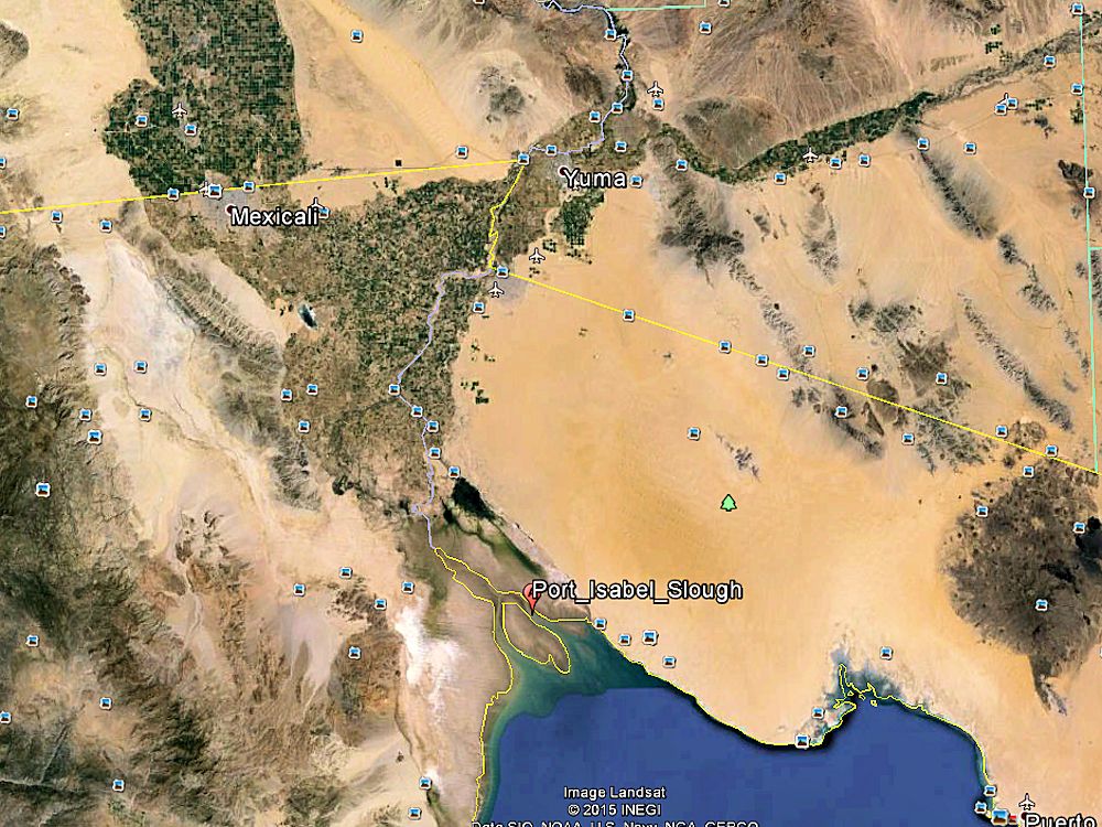
COLORADO RIVER DELTA AS IT EMPTIES INTO THE GULF OF CALIFORNIA
DISTANCES FROM THE DELTA TO YUMA TO THE VIRGIN RIVER
Philips Point may be regarded as the head of deep-water navigation in the Colorado River. At Philips Point spring tides rise 25 to 30 feet, and neap tides from 16 to 20 feet. At a short distance above Philips Point, the spring tide comes in with a bore or bank of water 4 feet high, extending in one huge breaker clear across the river, while the ebb is still running out. The influence of the tide in the Colorado River is felt for about 40 miles up the river, a few miles above Heintzelman's Point.(source)
COLORADO DELTA TO FORT YUMA
Phillips Point, Sonora
Head of eastern distributary channel of the Colorado River. 5 mi
Port Isabel Slough from 1865
Port Isabel, Sonora 1867
Steamship Anchorage, eastern distributary channel 7 mi Robinson's Landing, Baja California 10 mi Hardy River 23 mi Heintzelman's Point
Head of Tidewater 47 miPort Famine, Sonora 50 mi Lerdo Landing, Sonora 53 mi Gridiron, Sonora 67 mi Ogden's Landing, Sonora 95 mi Hualapai Smith's 105 mi Pedrick's, Arizona Territory 119 mi Jaeger City, California
Colorado City, Arizona Territory 149 miFort Yuma, California
Arizona City, Arizona Territory 1858
Yuma, Arizona Territory from 1873 150 mi
THE STERN-WHEELER COCHAN, COLORADO RIVER, YUMA AZ, CIRCA 1900
DISTANCES FROM FORT YUMA TO THE VIRGIN RIVER
Potholes, California, 18 mi Less than a mile south from the present day Laguna Diversion DamLa Laguna, Arizona Territory, 20 mi Covered by Lake Mittry created by Laguna Diversion DamCastle Dome Landing, Arizona Territory, 35 mi Eureka, Arizona Territory, 45 mi Williamsport, Arizona Territory, 47 mi Picacho, California, 48 mi Nortons Landing, Arizona Territory, 52 mi Lighthouse Rock, 61 mi Clip, Arizona Territory, 70 mi California Camp, California 72 mi Camp Gaston, California, 80 mi Drift Desert, Arizona Territory 102 mi Bradshaw's Ferry, California, 126 mi Mineral City, Arizona Territory, 126 mi Ehrenberg, Arizona Territory, 126.5 mi Olive City, Arizona Territory, 127 mi La Paz, Arizona Territory, 131 mi Parker's Landing, Arizona Territory,
Camp Colorado, Arizona, 200 miParker, Arizona Territory, 203 mi Empire Flat, Arizona Territory, 210 mi Bill Williams River, Arizona 220 mi Aubrey City, Arizona Territory, 220 mi Chimehuevis Landing, California 240 mi Liverpool Landing, Arizona Territory 242 mi Grand Turn, Arizona/California 257 mi The Needles, Mohave Mountains, Arizona 263 mi Mellen, Arizona Territory 267 mi Eastbridge, Arizona Territory 279 mi Needles, California, 282 mi Iretaba City, Arizona Territory, 298 mi Fort Mohave, Arizona Territory
Beale's Crossing 300 miMohave City, Arizona Territory, 305 mi Hardyville, Arizona Territory,
Current site of Bullhead City, Arizona
Laughlin, Nevada directly west across river
Low Water Head of Navigation 310 miCamp Alexander, Arizona Territory, 312 mi Polhamus Landing, Arizona Territory
Low Water Head of Navigation 315 miPyramid Canyon, Arizona/Nevada 316 mi Cottonwood Island, Nevada
Currently submerged by the waters of Lake Mojave. Cottonwood Valley 339 mi
Quartette, Nevada, 342 mi Murphyville, Arizona Territory, 353 mi Eldorado Canyon, Nevada
Colorado City, Nevada 365 miExplorer's Rock, Black Canyon of the Colorado, Mouth, Arizona/Nevada 369 mi Roaring Rapids, Black Canyon of the Colorado, Arizona/Nevada 375 mi Ringbolt Rapids, Black Canyon of the Colorado, Arizona/Nevada 387 mi Location of present day Hoover Dam 390 mi Fortification Rock, Nevada
High Water Head of Navigation, 400 miLas Vegas Wash, Nevada 402 mi Callville, Nevada
High Water Head of Navigation 408 miBoulder Canyon, Mouth, Arizona/Nevada 409 mi Stone's Ferry, Nevada 438 mi Virgin River, Nevada 440 mi
Bonelli's Ferry
Rioville, Nevada
High Water Head of Navigation 440 mi
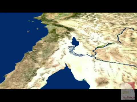
For the record, and for those who may be so interested, the river not reaching the gulf over a sustained period of time is or has been, a historical standard. Over the centuries nature changed the course of the Colorado any number of times, AND much more drastically than any of us have seen in our lifetimes. The following paragraph, backed by the video, from the sources so cited, say it best:
"In the distant past, the Gulf of California, which the Colorado river flows into, extended 150 miles further inland from its present shore. There it formed a large bay that was 50 miles wide. Each year the river deposited over 140,000 acre feet of silt at the rivers delta. This is enough to cover 214 square miles in 1 foot of soil. Eventually these accumulated deposits grew so thick as to seal off the upper portion of the gulf. Cut off from the river, the water that remained formed a huge lake eventually named Lake Cahuilla. When the Colorado flooded, its waters would spill into this lake. Over time, flooding, local run-off and evaporation made this a salt water lake."
(source)
CLICK IMAGE TO SEE THE FORMATION OF LAKE CAHUILLA
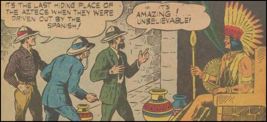
THE SECRET OF THE AZTEC TREASURE
GENE AUTRY COMICS, NOVEMBER 1942 VOLUME 1, ISSUE #3
(please click either image)
SHIP IN THE DESERT GENE AUTRY COMICS, JUNE 1951 ISSUE #52 -----
----
(please click any image)
LOST SHIP OF THE DESERT UNCLE SCROOGE COMICS, SEPTEMBER 1954 ISSUE #7 ----
----
(please click any image)
LAGUNA DIVERSION DAM
LAGUNA DAM COLORADO RIVER
VIKINGS OF THE DESERT SOUTHWEST
THE COLORADO RIVER: WAS IT NAVIGABLE?
GERMAN SUBMARINE ATTACK ON HOOVER DAM
DESERT SHIPS, SPANISH TREASURE
AND COLORADO RIVER FLOODS
(please click image)
THE WANDERLING
(please click)
FOR SOURCE OF COLORADO RIVER MILE DISTANCES CLICK
HERE
As to the subject of donations, for those of you who may be interested in doing so as it applies to the gratefulness of my works, I invariably suggest any funds be directed toward THE WOUNDED WARRIOR PROJECT and/or THE AMERICAN RED CROSS.